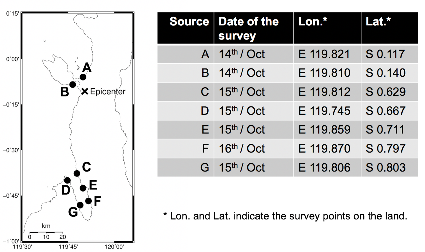
2018年インドネシア・パル(スラウェシ島)地震津波(インドネシア)
Report
Pleriminaly report for the field survey(速報)(Summery PDF)
MemBer
Taro Arikawa, Chuo University, Japan
Abdul Muhari, Ministry of Marine Affairs and Fisheries, Indonesia
Yoshihiro Okumura, Kansai University, Japan
Yuji Dohi, National Research Institute for Earth Science and Disaster Resilience, Japan
Bagus Afriyanto, Ministry of Marine Affairs and Fisheries, Indonesia
Karina Aprilia Sujatmiko, Institut TeknologiBandung, Indonesia
ITINERARY
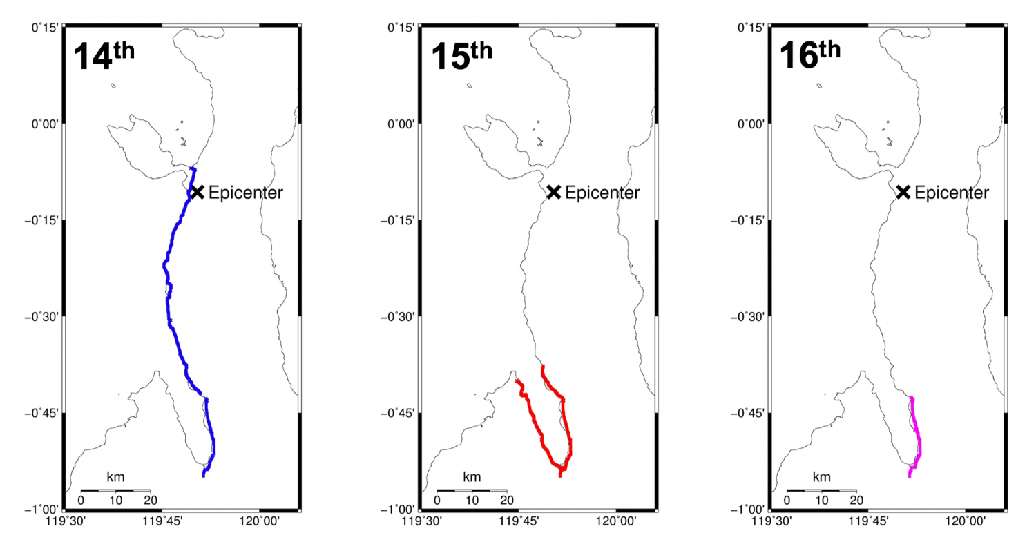
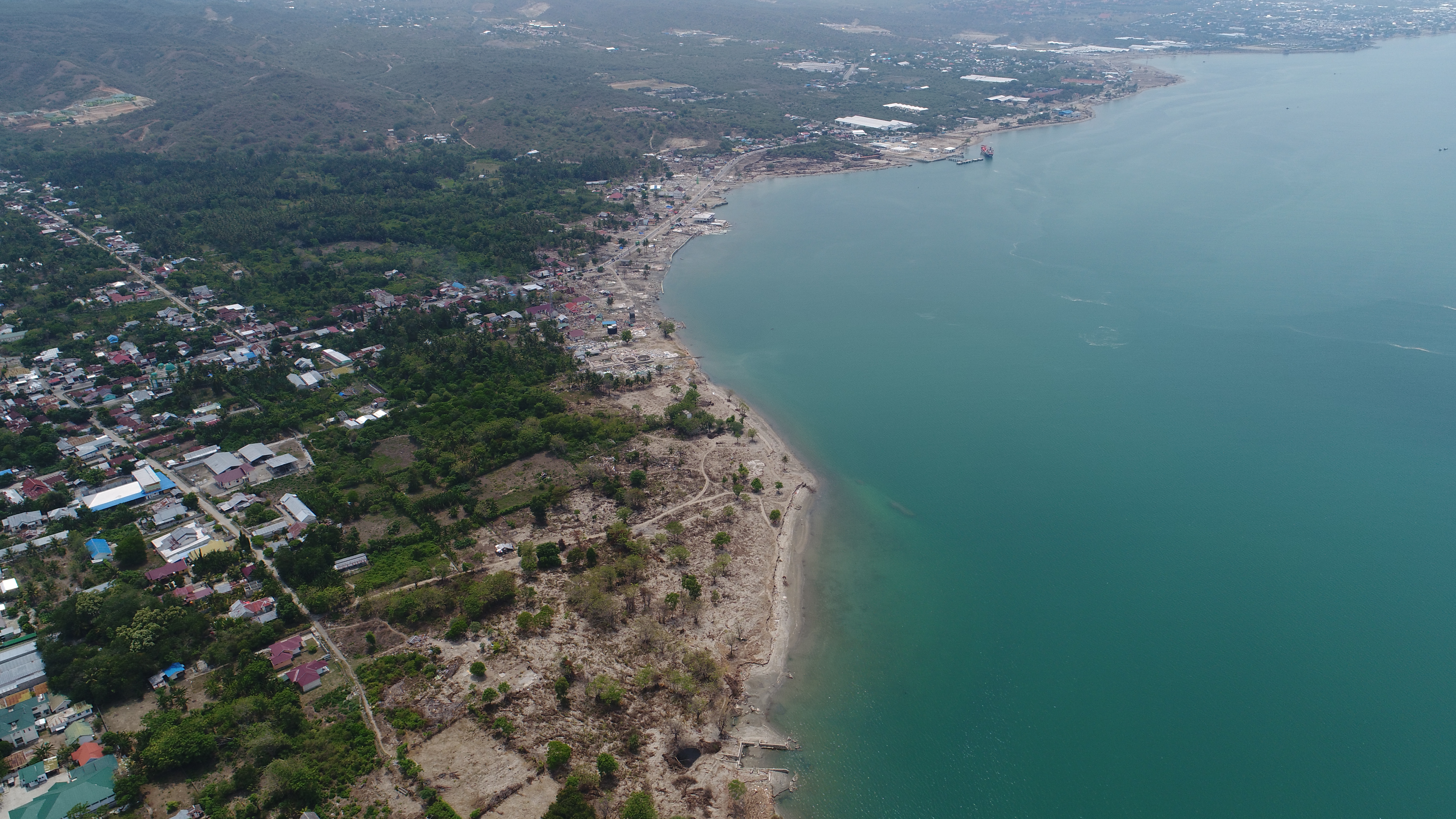
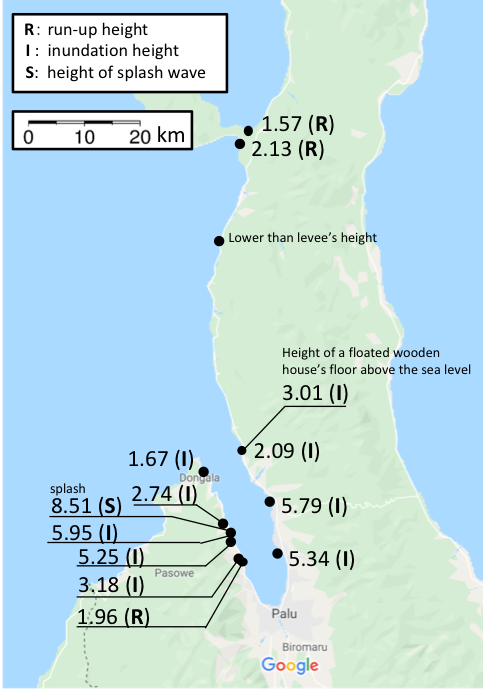
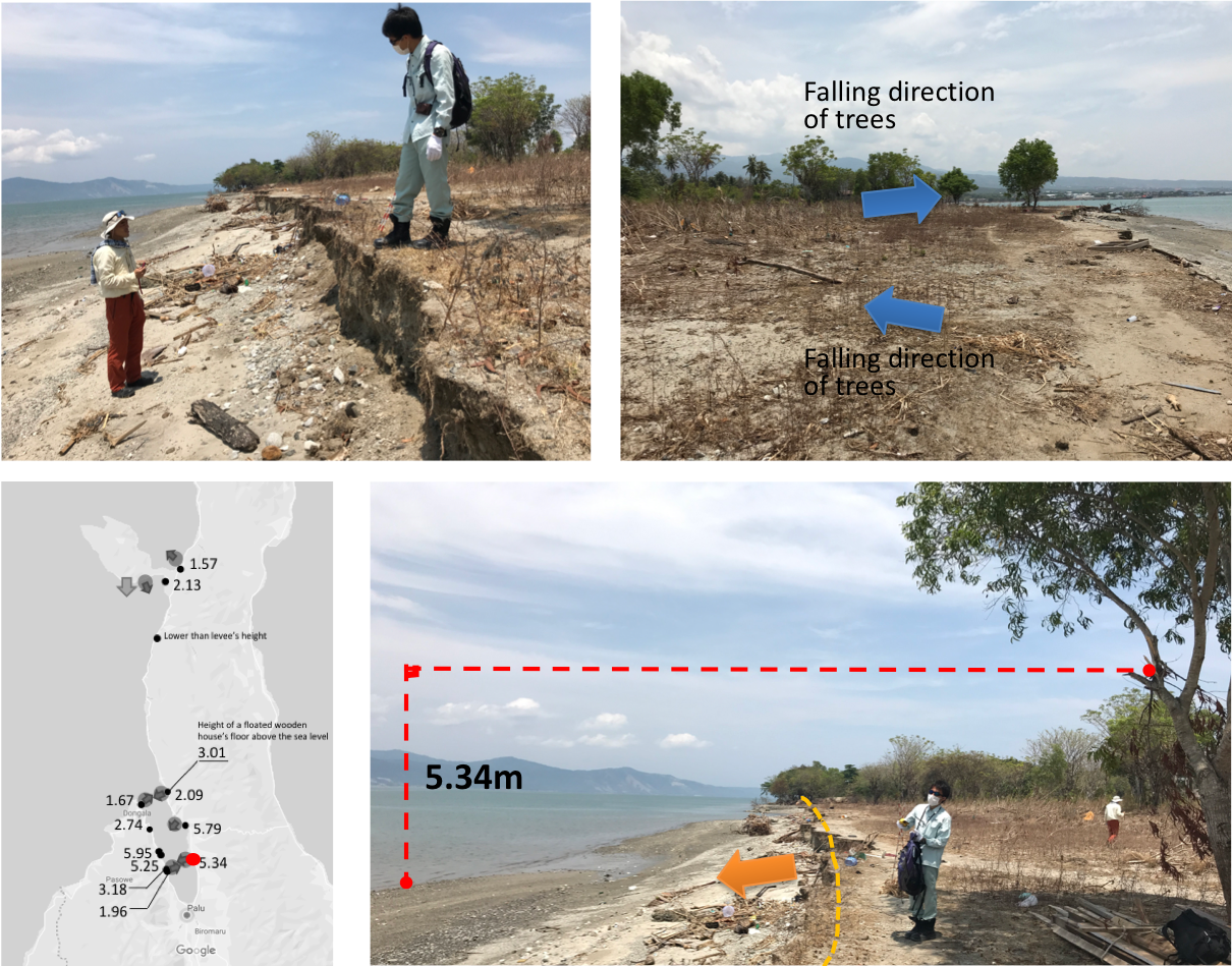
RESULT